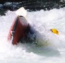
Paddled the Broad yesterday from Peak (Alston Rd landing) to Harbison State Forest. 8:30am - 3:30pm
About 2,200 CFS on the Alston gauge (http://waterdata.usgs.gov/sc/nwis/uv/?site_no=02161000&PARAmeter_cd=00065,00060,00062 ) This was a good level - enough water to slide over almost all the rocks and the take out at Harbison was manageable.
SC Trails (http://sctrails.net/trails/ALLTRAILS/WaterTrails/BroadRiverCanoe.html ) said it was about 17 miles (from the 213 bridge put in) - our GPS registered 15.2, including all the zigging and zagging that goes with a trip.
Pictures : https://goo.gl/photos/cBuizsDgQjk5NojD6
Saturday, June 12, 2010
Subscribe to:
Comments (Atom)
